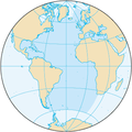
Fael:Atlantic Ocean.png
Atlantic_Ocean.png (330 × 330 pixels, fael ne kɛse: 26 KB, Nsɛnkyerɛdze asɛnka ahorow: image/png)
Fael abakɔsɛm
Mia da/ber no do na hwɛ mbrɛ nna fael no tse dɛm ber no.
| Da/Ber | Tɔfabɔ | Bɔbew nsusui | Dwumadzinyi | Nkasaho | |
|---|---|---|---|---|---|
| dza ɔwɔ do | 20:11, 27 Dzifuu 2019 |  | 330 × 330 (26 KB) | Kaldari | same dimensions as other ocean images |
| 20:20, 22 Dzifuu 2009 |  | 328 × 328 (12 KB) | Serg!o | ups | |
| 20:16, 22 Dzifuu 2009 |  | 329 × 330 (14 KB) | Serg!o | language neutral map | |
| 10:13, 3 Ɔberɛfɛw 2004 |  | 328 × 328 (12 KB) | Maximaximax | North and South Atlantic Ocean from [http://www.cia.gov/cia/publications/factbook/geos/zh.html CIA World Factbook - Atlantic Ocean] (picture URL is [http://www.cia.gov/cia/publications/factbook/maps/zh-map.gif]). {{PD-USGov}} Category:Oceans |
Fael no dwumadzi
Kratafa a odzidzi do yi dze dɛm fael yi yɛ edwuma:
Wiadze mfɛndzanan fael dwumadzi
Wikis afofor a wɔka do yi dze dɛm fael yi dzi dwuma:
- Yɛdze dzi dwuma wɔ ab.wikipedia.org
- Yɛdze dzi dwuma wɔ als.wikipedia.org
- Yɛdze dzi dwuma wɔ an.wikipedia.org
- Yɛdze dzi dwuma wɔ arc.wikipedia.org
- Yɛdze dzi dwuma wɔ ar.wikipedia.org
- Yɛdze dzi dwuma wɔ arz.wikipedia.org
- Yɛdze dzi dwuma wɔ ast.wikipedia.org
- Yɛdze dzi dwuma wɔ ast.wiktionary.org
- Yɛdze dzi dwuma wɔ as.wikipedia.org
- Yɛdze dzi dwuma wɔ av.wikipedia.org
- Yɛdze dzi dwuma wɔ az.wikipedia.org
- Yɛdze dzi dwuma wɔ ba.wikipedia.org
- Yɛdze dzi dwuma wɔ be-tarask.wikipedia.org
- Yɛdze dzi dwuma wɔ be.wikipedia.org
- Yɛdze dzi dwuma wɔ bg.wikipedia.org
- Yɛdze dzi dwuma wɔ bjn.wikipedia.org
- Yɛdze dzi dwuma wɔ bo.wikipedia.org
- Yɛdze dzi dwuma wɔ br.wikipedia.org
- Yɛdze dzi dwuma wɔ bs.wikipedia.org
- Yɛdze dzi dwuma wɔ bxr.wikipedia.org
- Yɛdze dzi dwuma wɔ ceb.wikipedia.org
- Yɛdze dzi dwuma wɔ ce.wikipedia.org
- Yɛdze dzi dwuma wɔ ckb.wikipedia.org
- Yɛdze dzi dwuma wɔ cs.wikipedia.org
Hwɛ dɛm fael yi no dwumadzi wɔ wiase nyinara mu bi ka ho.


